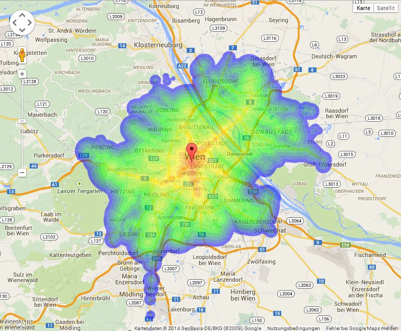
Station and connection data from a public transport authority is used to create an overlay using the google maps api. The overlay shows how long it takes from a certain point in the city to any other point, either by walking or by public transport.
[Caution: the rendering is done completely inside the browser and uses a lot of memory. Your machine may react sluggish and even crash. Follow the link at your own risk. You have been warned. :-) ]
Tested only for Chrome. Your mileage may vary.